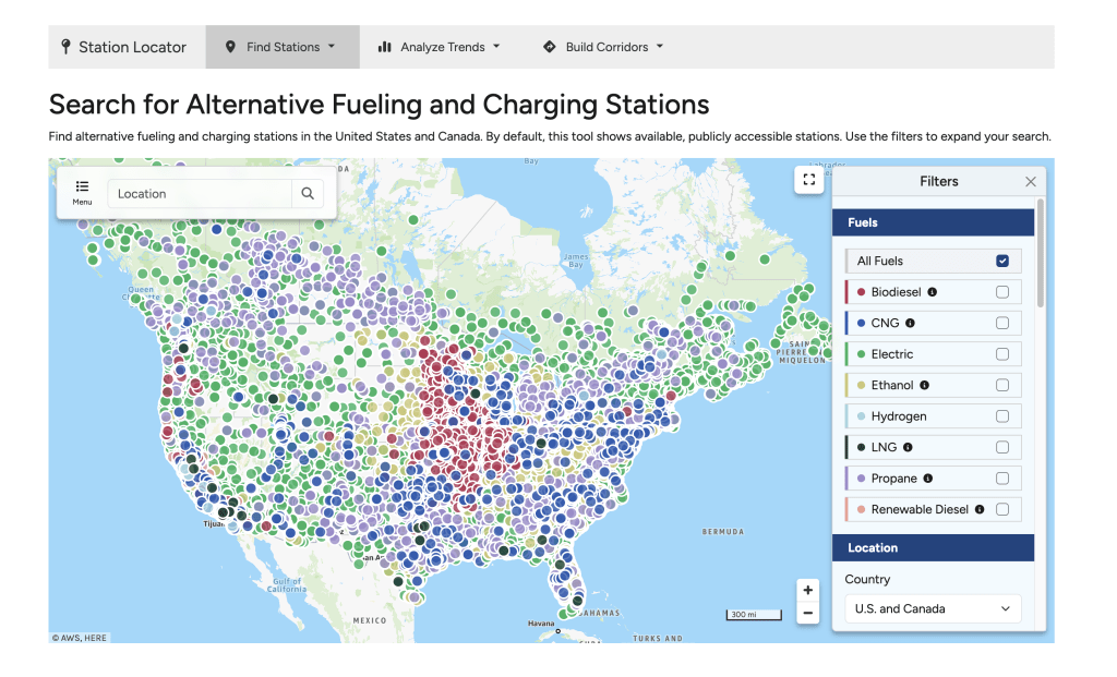
The Alternative Fueling Station Locator just got a major upgrade this year. As the most-used tool on the Alternative Fuels Data Center, the Station Locator now provides faster answers and better data sharing. New features include an enhanced mobile experience, richer map visualization, quicker search, historical data access, and expanded filtering.
To dive deeper into the new features, explore this summary:
- Location Search Options – As you type in the location search box, the tool now provides suggestions. You can also search by landmarks like national parks or choose the “Current Location” option to find stations nearby.
- Combined Filters – Instead of having separate views for standard and advanced filters, all filters are available now in the panel on the right.
- City and County Filters – You can now filter by city or county with an option to add multiple cities or counties to narrow your search.
- Searchable Filter for EV Charging Networks – The filter for charging networks is now searchable so you can type the specific network you’re looking for instead of scrolling through a list of 100+ networks.
- Group Nearby Stations – This new option in the filters allows you to view stations grouped on the map, which can help visualize station density and see overlapping stations on the map.
- Related Stations – For stations with co-located fuels, the station details screen now has tabs that show all the fuels offered at the station.
- My List – You can create a list of stations and view them on the map, which can help with planning a trip or creating a custom map to embed or share with stakeholders.
- Link to Results – A new button at the bottom of the filters panel provides an easy way to share a filtered version of the map or bookmark it for later.
- Alternate Routes – When using the “Map a Route” screen, there are now options for alternate driving routes—no longer just the shortest distance.
- Historical Maps – The new “Historical Date” filter lets you select a date back to 2014 to see what the landscape for fueling or charging looked like then.
- Historical Trends – A new page for summary charts provides a visualization of the historical stations data by fuel type.
- Corridors Layer – This layer shows alternative fuel corridors along highways designated by the Federal Highway Administration.
- Full-Screen Mode – The box icon to the left of the filters panel provides a full-screen experience, and you can collapse the search results panel and filters panel to focus on the map and create high-resolution screenshots.
- Mobile Experience – When visiting from a mobile device, you will see an abbreviated version of the filters with an option to expand the filters panel over the map.
- Navigation Menu – A new “Menu” button on the left provides a way to navigate between map views, add stations, and read about the data.